BMW Maps: the new navigation system for the German brand's models
 Victor Alós Yus @sepelaci
17 September 2026
2 min.
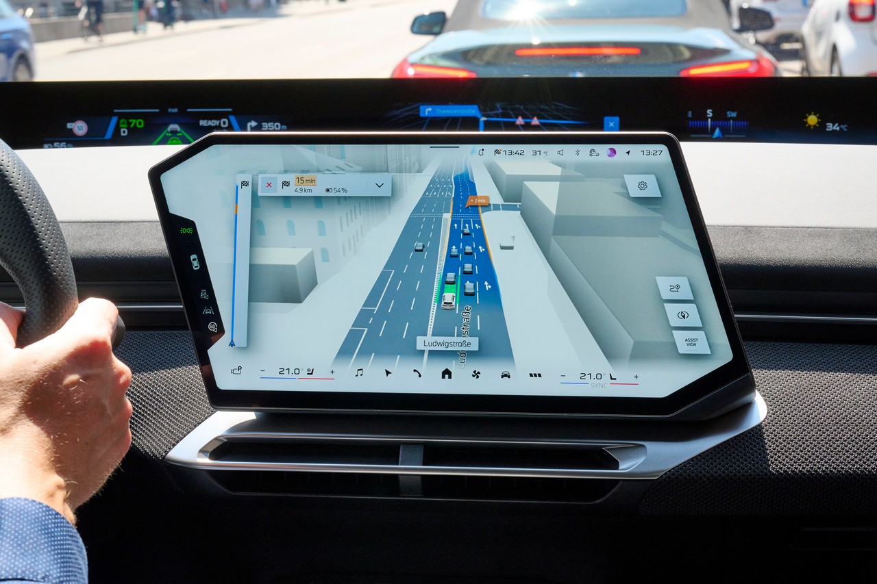
BMW will launch BMW Maps, a navigation system that integrates with driver assistance systems to enhance every journey with a model from the brand.
The most recent BMW models will feature a new navigation system, which will launch during October. All models equipped with the BMW X operating system will need to be updated to be fitted with this new navigation system. It will combine route guidance, the vehicle surroundings and driver assistance information in a single 3D view on the central screen.
The driver will not only see the next navigation step, but will also be able to see how the vehicle’s surroundings are perceived and which driver assistance systems are active at any given moment. The display shows the vehicle precisely within its lane and its exact position on the road. All this information allows the driver to act efficiently and select the most suitable driving mode at any time.
The integrated systems allow, for example, Highway Assistant 2 to provide hands-free driving on motorways at speeds of up to 130 km/h. With this system, acceleration and braking are controlled, as is the steering of the vehicle. Automated lane changes can be confirmed with a simple glance from the driver.
Galería de fotos -
BMW MAPS
In urban areas, these systems also work in an integrated way, which is becoming increasingly important. That is why, from 2027, BMW models equipped with BMW Operating System X will implement assisted and semi-autonomous navigation-guided driving in urban areas. It will start in Germany and will gradually reach other markets.
This system will work only with the BMW X operating system, as it has been developed entirely by the German brand with its models in mind.
https://youtu.be/YabvV5_APN8


 Peugeot E-208 GTi: a battery-powered toy that revives the spirit of the 1980s sports cars
 New Lexus ES: luxury grows and goes electric
 First contact with the Dacia Sandero Hybrid 155: power and efficiency from €19,890
Deja un comentario